The best Italian shops, delivered to your home.
Sign upOn sale
Recommended price€377.71save €198.30
3 payments of €59.80 with Klarna and PayPal
€6.10 delivery fee
Coming soon
Purchase protected by commercioVirtuoso
4.3 from 3,364 reviewsTrustpilot(opens in a new tab)If your item doesn't arrive or isn't as described, we guarantee your refund. Over 1,000,000 products delivered. How the guarantee works
Sign up on commercioVirtuoso.it to get free delivery on your first eligible order. Create an account now →
This product is shipped from Italy. If you buy from multiple sellers, the overall shipping fee is calculated at checkout.
Pay in 3 interest-free instalments on orders over €50. Available with Scalapay and PayPal.
| Today | In 1 month | In 2 months |
|---|---|---|
| €59.80 | €59.80 | €59.80 |
You have 15 days from delivery to return this product. Returns are guaranteed and you’ll get a return shipping label.
To start a return you need a registered account: guest-only purchases can’t open a return until the order is linked to your profile.
With an active account, go to My orders and select the order to return items from.
More on returns and refunds →Your purchases on commercioVirtuoso.it are covered by the marketplace guarantee. We also work to protect your data and privacy with payment systems that encrypt your details in transit. We never share your card data with third parties and we safeguard your personal data.
Why does this product have a 50% sustainability index? How the index works
Italian seller
Sold by a local business
Shipped from Italy
Lower delivery-related CO₂
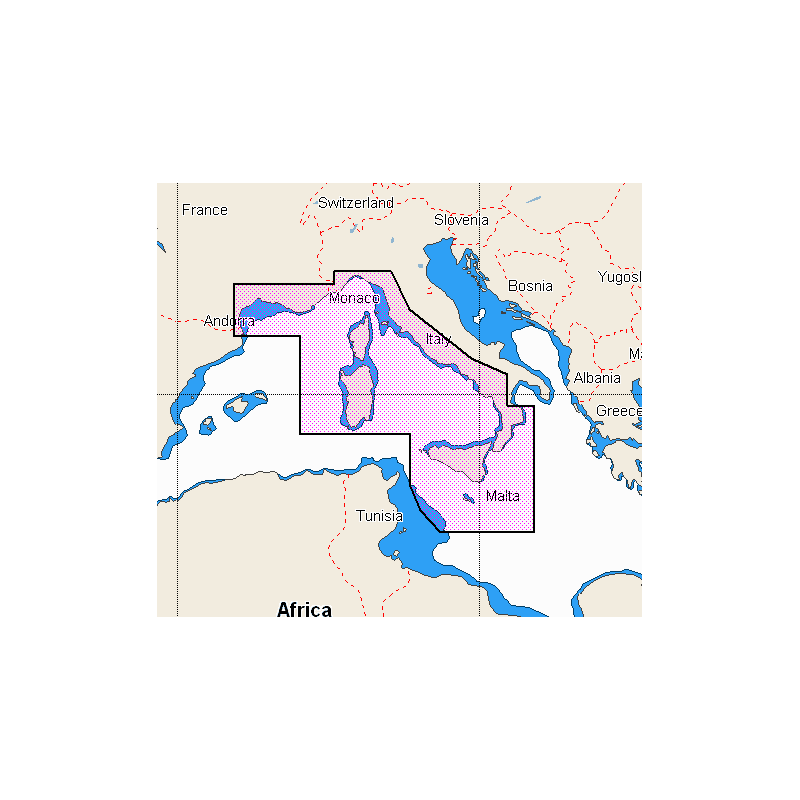
Mar Adriatico - Mar Ionio discover
€6.10 delivery fee
Mar Adriatico - Mar Ionio discover
€6.10 delivery fee
Cartografia per Lowrance, B&G, Simrad. Carte vettoriali, inclusi profondità, contorni, punti di scandaglio, NavAids, settori luce, relitti/ostacoli e altro ancora. Visualizza il più alto livello di informazioni, impostando chiare profondità di sicurezzae identificando pinnacoli sottomarini, sporgenze e canyon, magneti per la selvaggina costiera. Dettagli ad alta risoluzione di caratteristiche nearshore e offshore come pinnacoli, canyon e sporgenze che aiutano i pescatori, inclusi Dati Genesis. ROUTING FACILE SENZA ABBONAMENTO. Visualizza l’ora, il livello dell’acqua e la direzione delle maree con i grafici del livello di marea e indica l’ora corrente, la direzione e la forza previste. Grafici di flusso e frecce colorate. GRAFICI RASTER I grafici raster conferiscono un aspetto grafico tradizionale alla carta. RILIEVO OMBREGGIATO Shaded Relief presenta i dati con un aspetto 3D, che è più facile da interpretare rispetto alle curve di livello tradizionali. SATELLITE OVERLAY Le immagini satellitari forniscono riferimenti al mondo reale, miglioranola consapevolezza della situazione per la navigazione costieraVerificare che il software dello strumento sia l’ultima versione disponibile.